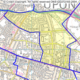
The resident population of Wingrove, as measured in the 2001 Census, was 10,569 of which 48 per cent were male and 52 per cent were female.
The resident population of Heaton, as measured in the 2001 Census, was 10,503 of which 48 per cent were male and 52 per cent were female.The resident population of Jesmond, as measured in the 2001 Census, was 11,849 of which 50 per cent were male and 50 per cent were female.
The resident population of Newcastle upon Tyne was 259,536, of which 48 per cent were male and 52 per cent were female.
Resident population (percentage)
Wingrove
Heaton
Jesmond
Newcastle upon Tyne
England and Wales
Under 16
23.4
10.9
10.3
18.8
20.2
16 to 19
5.7
6.3
4.8
5.8
4.9
20 to 29
22.1
36.4
39.2
16.6
12.6
30 to 59
34.2
31.8
32.3
38.4
41.5
60 to 74
9.3
8.5
6.8
12.8
13.3
75 and over
5.2
6.1
6.5
7.6
7.6
Average age
33.1
34.5
34.4
37.8
38.6
Source: 2001 Census, ONS
Marital Status
Resident population aged 16 and over (percentage)
Wingrove
Heaton
Jesmond
Newcastle upon Tyne
England and Wales
Single (never married)
43.4
60.0
61.4
38.1
30.1
Married or re-married
40.4
27.2
27.1
42.0
50.9
Separated
2.9
1.8
1.4
2.8
2.4
Divorced
6.7
5.2
4.6
8.1
8.2
Widowed
6.6
5.8
5.6
9.0
8.4
Source: 2001 Census, ONS
Ethnic Group
Resident population (percentage)
Wingrove
Heaton
Jesmond
Newcastle upon Tyne
England
White
75.3
92.4
92.8
93.1
90.9
of which White Irish
0.8
1.4
1.5
0.7
1.3
Mixed
1.8
1.3
1.5
0.9
1.3
Asian or Asian British
19.8
4.9
3.9
4.4
4.6
Indian
2.8
1.4
2.2
1.2
2.1
Pakistani
13.1
2.4
1.1
1.9
1.4
Bangladeshi
3.2
0.9
0.3
1.0
0.6
Other Asian
0.8
0.3
0.3
0.3
0.5
Black or Black British
0.8
0.5
0.3
0.4
2.1
Caribbean
0.1
0.1
0.1
0.0
1.1
African
0.5
0.4
0.2
0.3
1.0
Other Black
0.2
0.1
0.0
0.0
0.2
Chinese or Other Ethnic Group
2.3
0.9
1.5
1.2
0.9
Source: 2001 Census, ONS
Religion
Resident population (percentage)
Wingrove
Heaton
Jesmond
Newcastle upon Tyne
England and Wales
Christian
53.8
59.8
60.4
70.6
71.8
Buddhist
0.3
0.5
0.5
0.3
0.3
Hindu
1.0
0.7
1.4
0.6
1.1
Jewish
0.2
0.2
0.7
0.3
0.5
Muslim
18.2
3.7
2.2
3.6
3.0
Sikh
1.7
0.3
0.5
0.4
0.6
Other religions
0.3
0.3
0.3
0.2
0.3
No religion
17.2
27.3
27.2
16.0
14.8
Religion not stated
7.2
7.2
6.7
7.8
7.7
Source: 2001 Census, ONS
Health and provision of care
The 2001 Census asked people to describe their health, over the preceding 12 months as 'good', 'fairly good' or 'not good'.
Resident population (percentage)
Wingrove
Heaton
Jesmond
Newcastle upon Tyne
England and Wales
Good
70.0
70.4
78.5
65.1
68.6
Fairly good
20.4
20.9
16.2
23.1
22.2
Not good
9.6
8.7
5.3
11.8
9.2
Source: 2001 Census, ONS
It also asked questions about any limiting long-term illness, health problem or disability which limited peoples daily activities or the work they could do.
Resident population (percentage)
Wingrove
Heaton
Jesmond
Newcastle upon Tyne
England and Wales
With a limiting long-term illness
17.6
16.0
12.0
21.6
18.2
Source: 2001 Census, ONS
For the first time, the 2001 Census asked a question about any voluntary care provided to look after, or give any help or support to family members, friends, neighbours or others because of long term physical or mental ill-health or disability, or problems relating to old age.
Resident population (percentage)
Wingrove
Heaton
Jesmond
Newcastle upon Tyne
England and Wales
Provided unpaid care
9.4
7.2
7.4
10.1
10.0
Source: 2001 Census, ONS
There are two main benefits associated with health that are paid to people needing help with personal care. They are the 'Disability Living Allowance' and the 'Attendance Allowance'.
The Disability Living Allowance is a benefit paid to people under 65, who are disabled, and need help with personal care, and/or getting around. In August 2000, 12,950 people in Newcastle upon Tyne received this benefit. Source: Department for Work and Pensions, 2000
The Attendance Allowance is paid to people over the age of 65, who are so severely disabled, physically or mentally, that they need supervision or a great deal of help with personal care. In May 2000, 6,635 people in Newcastle upon Tyne received this benefit. Source: Department for Work and Pensions, 2000
Economic Activity
Resident population aged 16 to 74 (percentage)
Wingrove
Heaton
Jesmond
Newcastle upon Tyne
England and Wales
Employed
46.0
47.7
49.4
50.0
60.6
Unemployed
4.9
3.8
2.4
4.7
3.4
Economically active full-time students
5.1
8.5
6.2
3.8
2.6
Retired
9.4
8.1
6.1
13.2
13.6
Economically inactive students
14.4
22.0
29.1
10.0
4.7
Looking after home/family
7.8
3.0
2.4
6.2
6.5
Permanently sick or disabled
7.1
4.7
2.6
8.5
5.5
Other economically inactive
5.4
2.2
1.8
3.7
3.1
Source: 2001 Census, ONS
Within Wingrove, 10 per cent of those unemployed were aged 50 and over, 19 per cent had never worked and 34 per cent were long term unemployed. Source: 2001 Census, ONS
In August 2000, there were 6,940 Jobseeker Allowance claimants in Newcastle upon Tyne of which 27 per cent had child dependants. The Job Seeker Allowance (JSA) is payable to people under pensionable age who are available for, and actively seeking, work of at least 40 hours a week. Figures produced here are those only for people claiming income-based JSA. Source: Department for Work and Pensions, 2000
In August 2000, there were 27,680 Income Support claimants in Newcastle upon Tyne, of which 3 per cent were aged under 20. Income support was introduced on April 11th 1988 and can be paid to a person who is aged 16 and over, is not working 16 hours or more a week, and has less money coming in than the law says they need to live on. Source: Department for Work and Pensions, 2000
Students and Qualifications
Students and schoolchildren aged 16 to 74
Wingrove
Heaton
Jesmond
Newcastle upon Tyne
England and Wales
Total number of full-time students and schoolchildren aged 16 to 74
1,425
2,618
3,435
25,747
2,648,992
Percentage of total resident population
13.5
24.9
29.0
9.9
5.1
Total number aged 16 to 17
208
127
143
4,513
1,014,284
Total number aged 18 to 74
1,217
2,491
3,292
21,234
1,634,708
Note : Students and schoolchildren were counted at their term-time address. Source: 2001 Census, ONS
Resident population aged 16 to 74 (percentage)
Wingrove
Heaton
Jesmond
Newcastle upon Tyne
England and Wales
Had no qualifications
29.9
16.2
6.3
32.6
29.1
Qualified to degree level or higher
24.0
34.4
47.5
20.8
19.8
Source: 2001 Census, ONS top Housing and Households
In Wingrove there were 3,885 households in 2001. 100 per cent of the resident population lived in households. The remainder of the population lived in communal establishments. The number of households in Newcastle upon Tyne was 111,243.
Number of households (percentage)
Wingrove
Heaton
Jesmond
Newcastle upon Tyne
England and Wales
One person households
28.2
34.5
36.4
35.2
30.0
Pensioners living alone
12.2
11.6
11.0
16.2
14.4
Other All Pensioner households
6.4
5.6
4.8
8.0
9.4
Contained dependent children
34.4
16.9
15.8
26.9
29.5
Lone parent households with dependent children
8.4
4.3
2.2
7.1
6.5
Owner occupied
55.0
53.9
55.0
53.3
68.9
Rented from Council
14.7
7.3
2.0
28.0
13.2
Rented from Housing Association or Registered Social Landlord
5.0
6.0
5.7
5.5
6.0
Private rented or lived rent free
25.2
32.8
37.3
13.2
11.9
Without central heating
5.6
8.6
5.9
4.2
8.5
Without sole use of bath, shower or toilet
0.2
0.2
0.4
0.2
0.5
Have no car or van
43.3
41.5
28.4
45.2
26.8
Have 2 or more cars or vans
15.8
15.4
28.0
15.4
29.4
Average household size (number)
2.7
2.3
2.3
2.3
2.4
Average number of rooms per household
5.6
5.1
5.6
5.0
5.3
Source: 2001 Census, ONS
£'s and number of households (percentage)
Newcastle upon Tyne
England & Wales
Average price
Percentage of households living in this type of property
Average price
Percentage of households living in this type of property
Detached
150,516
7.5
178,806
22.8
Semi-detached
78,891
34.8
101,733
31.6
Terraced
79,285
27.4
89,499
26.0
Flat
68,937
30.2
120,185
19.2
All property types
82,836
119,436
Sources: 2001 Census, ONS
The Land Registry, 2001 top Area Statistics
Levels Of Crime in Newcastle upon Tyne
Notifiable offences recorded by the police. April 2000 to March 2001.
Violence against the person
Sexual offences
Robbery
Burglary from a dwelling
Theft of a motor vehicle
Theft from a motor vehicle
Total number of offences recorded,
Newcastle upon Tyne
1. This summary brings together data from a number of sources, all of which are available elsewhere within the Neighbourhood Statistics website. More detailed information on these topics and others, is available within the site and can be viewed through a number of ways.
by subject;
by a list of areas;
by using the interactive map.
2. In some cases the data shown in this summary may have been rounded and figures shown may differ slightly from those published elsewhere. Due to rounding of percentages, the addition of categories may not sum to exactly 100 per cent in all cases. It should also be noted that in some cases, different tables may show different counts for the same population, due to disclosure protection measures used to prevent the inadvertent disclosure of information about identifiable individuals. Figures quoted should therefore be used for guidance only.
3. These summary statistics are based on administrative ward boundaries legally in force at the end of 2002, which includes ward boundaries that became operative in a number of Local Authorities in May 2003, and some others that will become operative in May 2004.
4. The symbol ".." is used to indicate that the value is not available.
Copyright
This material is Crown Copyright.
Users are granted permission to reproduce Crown Copyright material provided that a Click-Use Licence has been obtained from HMSO. The Click-Use Licence can be obtained from www.clickanduse.hmso.gov.uk . When reproducing this material, copyright and source should be acknowledged.